Monographs
by Institute
collaborators

Monographs by Institute collaborators published in 2015
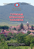
Željko Bjeljac, Jovan Romelić
The Geographical Institute “Jovan Cvijić” of the Serbian Academy of Sciences and Arts, special editions, vol. 89, Belgrade, 2015.
Book description. In preparation.
Monographs by Institute collaborators published in 2014
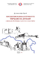
Aleksandra Terzić
The Geographical Institute “Jovan Cvijić” of the Serbian Academy of Sciences and Arts, special editions, vol. 88, Belgrade, 2014.
Book description. In preparation.
Monographs by Institute collaborators published in 2013
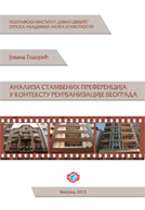
Jovana Todorić
Residential preferences analysis in the context of reurbanisation in Belgrade
The Geographical Institute “Jovan Cvijić” of the Serbian Academy of Sciences and Arts, special editions, vol. 86, Belgrade, 2013.
Book description. In preparation.
Aleksandra Spalević
Transformation of peri-urban area of Belgrade
The Geographical Institute “Jovan Cvijić” of the Serbian Academy of Sciences and Arts, special editions, vol. 85, Belgrade, 2013.
Book description. In preparation.
Monographs by Institute collaborators published in 2012
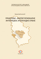
Marija Drobnjaković
Prijepolje - factor of the regional integrity of the south-west Serbia
The Geographical Institute “Jovan Cvijić” of the Serbian Academy of Sciences and Arts, special editions, vol. 84, Belgrade, 2012.
Book description. Monograph "Prijepolje - factor of the regional integrity of the south-west Serbia" is original scientific work written based on the theoretical knowledge, scientific methods, field researches, domestic and foreign scientific and professional literature. Monograph by Marija Drobnjaković presents urban geographical study of functional urban area of Prijepolje (community of Prijepolje, Priboj and Nova Varos).
Analysis of observed space was done for period from year 1971 until year 2002. The book consists of 6 chapters presented on 203 pages. The work includes also 24 tabelar notes, 4 cartographic supplements and 34 graphic supplements. In the introduction of monograph, the time and space frame of the researches are defined. The author emphasizes that the subject of the research is defining hierarchy and spatial functional relations in the net of communities of functional urban area of Prijepolje.
Theoretical and practical frame of researches is related to territorial organization and uneven regional development of Republic of Serbia as well as necessity of establishment of functional space integrity with functional urban areas, considering practice in the countries of European Union. Third chapter contains review of natural-geographic and cultural-historic characteristics of the researched space, presented through smaller partscommunication position of Prijepolje and nearby communities, physical characteristics and development of communities through history. Analysis of spatial demographic and spatial functional characteristics of the areas are presented in chapter Internal structure of functional urban area of Prijepolje - interregional changes. Demographic processes are especially emphasized as a significant determinant of community network. Vertical and horizontal division of communities is defined according to the spatial arrangement of the population. Functional characteristics of the communities and spatial arrangement of economic subject have determined a degree of economic development and functional determination of particular communities. With that was done a base for model creation of future development of community net of functional area of Prijepolje. In the key chapter of monograph work comparative analysis of spatial functional organization and degree of regional development of functional area of Prijepolje and nearby functional areas have contributed to clear determination of role and signification of functional urban area of Prijepolje in wider regional environment, and a relation with other functional urban areas of south-west Serbia and over border space. Indicators of regional linking of areas are daily movement of the population, accessibility and competition of regions and possibility of collaboration.
The author in final considerations as a conclusion mention the possibility and necessity of constitution of larger region, in the observed part of Serbia which would be constituted from functional areas of Uzice, Prijepolje and Novi Pazar. Also the author suggests possible directions of cooperation through trans-border and trans-regional connection of functional area of Prijepolje, with nearby community in Montenegro (Pljevlja and Bijelo Polje) and in The Serb Republic (Rudo). We could make conclusion that the results of investigation presented in monograph "Prijepolje factor of regional integrity of the south-west Serbia" by Marija Drobnjaković are base for appropriate territorial organization of Serbia, for establishment of interregional and trans-border cooperation and regional integration in south-west Serbia. Monograph will find its position in further applied researches in the area of regional development and cooperation between regions.
Monographs by Institute collaborators published in 2011
Vesna Lukić
Demographic Development and Functional Structure of Pancevo
The Geographical Institute “Jovan Cvijić” of the Serbian Academy of Sciences and Arts, special editions, vol. 83, Belgrade, 2011.
Book description. This publication is based on geographic and demographic researches and analysis of the functional structure of Pancevo. The book is structured into three major thematic areas. In the first, short, chapter the author gives a review of traffic and geographical position of Pancevo, then a historical representation of the territorial organization of the area of south Banat and the change of place and role of the town within various administrative-territorial units, as well as an overview of development of the settlement since its inception to the present days. Another part of the monograph relates to the population development of Pancevo in the period after World War II. Within this section, population dynamics and changes in spatial distribution of population were analyzed, followed by natural and mechanical components of population movements and changes in population and household structures. Functional structure of Pancevo is the theme of the third part of the monograph. Presenting the reader argumentative analysis of the book, the author emphasizes that the development of Pancevo was significantly affected by traditionally developed industry, presented with large complexes of broader national significance. Particular emphasis is placed on the role of industry in the functional development of Pancevo since the 60's and 70's of the 20th century. Within this section, relying on economic indicators, the situation and processes in the labour market with a comparison of Pancevo with the wider environment were analyzed. Great attention was paid to the study of commuting flows in the daily urban system of Pancevo, taking into account relevant elements and factors of commuting and the complexity of this form of spatial mobility of population. In concluding remarks, by giving synthesized assessment, the author proves the impact of development of the town on its demographic and functional changes, as well as changes in the daily movements of population between town and the immediate and wider environment. The author estimates that the future population (with an emphasis on the migration component) and functional development of the municipality of Pancevo will largely depend on changes in strength of functional and transport links with Belgrade and changes in the structure of the economy of Pancevo. This monograph represents a unique scientific publication, necessary for the understanding of demographic processes, functional structures and commuting, as in the municipality of Pancevo, so broader.
Monographs by Institute collaborators published in 2010
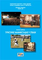
Željko Bjeljac
The Geographical Institute “Jovan Cvijić” of the Serbian Academy of Sciences and Arts, special editions, vol. 82, Belgrade, 2010.
Book description. A book Tourist events in Serbia, represent an original scientific moniography, written on the basis of field research (surveys, interviews) and with using of domestic and foreign scientific literature. The book contains seven chapters on 176 pages. The event tourism can be defined as public performance of an event or several events (of the same or different contents) of various categories of human achievements identified according to their particularity and attractiveness, realizing tourist effects and goals, and organised in all settlements that have interest in that, with massive appearance and public expression significant by the extent, size, quality and quantity of the contents and clearly expressed central subject, recognisable term of holding by which the profitability is realised as the part of tourist destination. From the beginning of the 1980s the event tourism has been mentioned in the world as separate industry. In Serbia, the event tourism gained significance as economically prosperous form of tourism by the first half of the first decade of the 21st century. In 2010, 2 426 traditional events were held in Serbia. The following event are identified according to the contents: artistic (628 i.e. 25.89%); economic (451 i.e. 18.59%) children (272 i.e. 21%) entertaining, religious (143 i.e. 5.89%), political-historical (77 i.e. 3.17%), tourist-propaganda (16 i.e. 0.66%), sports (368 i.e. 15.17%), scientific (54 i.e. 2.26%) and ethnographic (227 or 9.36% of the total number of events). Cultural centres 457 (18.84%), sports clubs and associations 359 (14.80%), local authorities 353 (14.55%), non-governmental organisations 239 (9.85%), tourist organisations 150 (6.18%) and artistic associations 113 (4.66%) have mainly been the organisers of the events. The basic division of this form of tourism can be done on the basis of the complex and detailed analysis. The division on the basis of geographical and economic group of criteria is developed by Ž. Bjeljac on the basis of his ten-year researches. Geographical group of criteria includes contents; the origin of participants according to rank, i.e. significance; tradition; the location (place) of holding; traffic accessibility; time of holding; the number of visitors and participants; the artistic value of the event; accompanying events; contentment of visitors; the organisers of the event. All these indicators are judged by points from zero to five. Based on tourist valorisation, the events that belong to the first and the second category of tourist events are singled out. The first category includes: ‘Dragačevo Trumpet Festival’, Guča (115 points), ‘Exit’, Novi Sad (114 points), ‘Haymaking on Rajac Mt.’, Ljig (110 points), ‘International Fair of Agriculture’, Novi Sad and ‘Vintage days’, Vršac (108 points each), ‘International Book Fair’, Belgrade (106 points), ‘Beer days’, Zrenjanin (105 points), ‘Vuk’s festival’ Tršic (104 points), ‘International Fairs of Hunting, Fishing, Sports and Tourism’, Novi Sad (101 points); International Fair of Tourism, Belgrade (100 points), ‘The First Serbian Concertina’, Sokobanja (98 points), ‘Dužijanca’, Subotica (97 points). Based on the research, some events in Serbia represent the significant segment of tourist offer and extremely important element in the development of the selective forms of tourism by their long tradition of holding, attractiveness and ambience of holding, as well as their forged image. Some events, outgrowing the national frames and acquiring a reputation on the international market, are positively differentiated and they become the recognisable brands the attractive power of which increases, while the economic effects rapidly increase the profit realised from tourism.
Jovana Brankov
Ecological Tourism in Protected Natural Assets in Banat
The Geographical Institute “Jovan Cvijić” of the Serbian Academy of Sciences and Arts, special editions, vol. 81, Belgrade, 2010.
Book description. In preparation.
Milena Panić
The Geographical Institute “Jovan Cvijić” of the Serbian Academy of Sciences and Arts, special editions, vol. 80, Belgrade, 2010.
Book description. The book "Hazardous waste management - planning, organization and system functioning" is organized into six chapters. The first chapter started from the definition of the hazardous waste, considering it's main characteristics and the existing classification in the EU and the U.S. It is also presented the life cycle of hazardous waste from its generation, collection, storage, transport, to treatment and final disposal, including applicable principles and mechanisms that allow its long-term sustainable operation. The second chapter overviewed the existing EU legislation in the field of hazardous waste, and then other forms of legal regulation of the aforementioned issue. In the third chapter, the specific examples of Austria, Ireland and Croatia, were analyzed by different approaches and mechanisms used in the organization, establishment and control of national hazardous waste system, as well as data on actual hazardous waste quantities, minimization options, treatment and disposal of hazardous waste. Then in the fourth chapter, an insight into the condition and operation of all hazardous waste options in the Republic of Serbia, with an analysis of the legislative, institutional and planning framework. Strategic framework and the necessary, concrete proposals and solutions prescribed by the applicable plan documents, which relate to existing national hazardous waste system are presented in chapter five. Rhe sixth chapter is perceived ability to use GIS for hazardous waste management, with special emphasis on it's use in planning of transportation and disposal of hazardous waste.
Marko V. Milošević
Landslides in Jagodina Municipality
The Geographical Institute “Jovan Cvijić” of the Serbian Academy of Sciences and Arts, special editions, vol. 79, Belgrade, 2010.
Book description. In preparation.
Jugoslav Nikolić
The Geographical Institute “Jovan Cvijić” of the Serbian Academy of Sciences and Arts, special editions, vol. 78, Belgrade, 2010.
Book description. One of the key problems, before practical applications, represents verification of the numerical models for determination of the evapotranspiration. This process is often complex and relatively longterm. The monograph “The Verification of the Evapotranspiration Model – Hydrogeological, Hydrological, Geographical and Meteorological Research on the Case Example of the Zapadna Morava Upper River Basin”, among other things, contains the presentation of practically applicable methodology of the model verification. In the calibration process of the developed numerical model, lysimetric station of the Republic Hydrometeorological Service of Serbia was used, as well as the meteorological station on the same location. The verification of the model was performed for heterogeneous geological conditions on the case example of the Zapadna Morava upper river basin. In order for this process to be performed it was necessary, through multidisciplinary approach, to conduct thorough examination of chosen terrains from different aspects: geological, geomorphological, hydrological, hydrogeological, meteorological and geographical. The evapotranspiration field was determined by the model application, more exactly by calculation in large number of network dots, which represent the elementary surfaces by which space is divided from model domain. Due to the lack of lysimetric measurements on terrain, the additional influences of geological foundations on correction of the integral water evaporation are solved in a specific way, through comparable determination of water evaporation by the water balance method, along with complex hydrogeological terrain research and model-based precipitation determination.
Jugoslav Nikolić
The Geographical Institute “Jovan Cvijić” of the Serbian Academy of Sciences and Arts, special editions, vol. 77, Belgrade, 2010.
Book description. The content of the monograph “The Water Evaporation in Heterogenous Geological Conditions – Development of Numerical Model for Determination of the Evapotranspiration” is very up-to-date for hydrogeology, hydrology, meteorology, geography, forestry, ecology, environmental protection, agriculture and many other scientific disciplines. The research presented in the monograph, with the goal of production and inception testing of the model for determination of the evapotranspiration in natural environments and taking into consideration influences of various hydrogeological terrain conditions, resulted in obtained tool that represents contribution to a more successful solving of numerous practical problems. The research results represent contribution to a more accurate determination of the total water evaporation through model application on a river basin or basin area, which represents a part of a wider basin. The essential advantage of the developed model is a good physical foundation of basic model equation and possibility of practical application without excessive investments for special measurements. The model includes processes that primarily regulate the evapotranspiration. One of them is the absorption of Solar energy that secures latent evaporation heat to active surface, and the other is the mechanism of water vapor transportation from evaporation surface. The model also contains module for calculation of spatial-time albedo dependability in function of vegetation, snow cover and Sun elevation. The surface resistance of plant cover is also included, which simulates control of water vapor flow from leaves of vegetation to surrounding space as well as aerodynamic resistance in function of wind speed and coarseness of active surface. Due to common shortage of lysimetric measurements on terrain, additional influences of geological foundations on correction of integral water evaporation are solved through parametrization. The model input are adequate parameters from model domain that are measured routinely, on the regular basis, by the authorized institutions as well as certain parameters that are determined by carthometric way. The output from the numerical model is the evapotranspiration field.
Dragana Milijašević
Hydrogeographic Study of the Đetinja River
The Geographical Institute “Jovan Cvijić” of the Serbian Academy of Sciences and Arts, special editions, vol. 76, Belgrade, 2010.
Book description. In preparation.
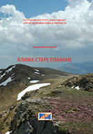
Boško Milovanović
Climate of the Mountain Stara Planina
The Geographical Institute “Jovan Cvijić” of the Serbian Academy of Sciences and Arts, special editions, vol. 75, Belgrade, 2010.
Book description. The book consists of seven chapters. It deals with median monthly and annual air temperatures, the absolute maximum and minimum air temperatures, median maximum and median minimum air temperatures, median monthly and annual precipitation, the number of snow cover days, combined climatic elements. For the purpose of distinguishing climatic regions in the area of Stara planina, we used the data for the 1961-2000 period, and for the purpose of researching the climatic fluctuations in the area, we used the data for the 1951-2000 period. The most important results pertain to the temperature and the pluviometric regime in the area under observation, but also to the significance of certain climatic factors for the spatial distribution of these climatic elements. From the point of view of climate fluctuations, it has been shown that Stara planina and its rim represent a very interesting spatial whole where the amount of precipitation significantly decreased in the course of the period of observation, and where there is both a positive and a negative trend concerning air temperature.
Monographs by Institute collaborators published in 2009
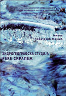
Jelena Kovačević-Majkić
A Hydrogeographic Study of the Skrapež River,
The Geographical Institute “Jovan Cvijić” of the Serbian Academy of Sciences and Arts, special editions, vol. 74, Belgrade, 2009.
Book description. The book consists of seven chapters and two tables. The insufficient quantity of water in summer months, as well as the frequent flooding of Požeško polje [Požega Field], the great monthly fluctuations in the river’s flow, the greater proportion of surface runoff in relation to ground water runoff, the low drainage coefficient (28%), the almost equal length of permanent and periodic flows, all point to the torrential character of the Skrapež River and its tributaries, and to the fact that its hydrographic characteristics are not favourable for water resources exploitation. Therefore, in the chapter dealing with the problems of water resources exploitation in the basin of this river (erosion, torrents, floods, the problem of supplying water to settlements and industrial plants, irrigation and drainage), it is suggested that using the waters of the hitherto unexplored subbasins of the Skrapež River could supply a solution to the problem. In order to be able to speak of a rational exploitation of the waters of the Skrapež River basin, it is pointed out that preconditions for this need to be created, which primarily presupposes regulating the flows and the basins, and only after the realisation of this could the possibility of creating accumulation lakes be contemplated (Seča reka and Bjeloperice, the zones mentioned in the Landscape Plan as being reserved for this purpose). In this respect, this study is applicative in character, for by using a raster GIS and calculating the amount of precipitation for each area desired and the quantities of water available from the tributaries of the Skrapež River, it facilitates the
Dragana Matijević
The Spatial-functional Connection between the Settlements of the Stara Pazova Municipality and the Urban System of Belgrade,
The Geographical Institute “Jovan Cvijić” of the Serbian Academy of Sciences and Arts, special editions, vol. 73, Belgrade, 2009.
Book description. The book is composed of nine parts: I The theoretical-methodological premises; II The geographic position; III The genesis and the historical development of the settlement; IV The demographic development and demographic structures of the settlement; V A typological systematisation of the settlement; VI Contemporary transformations of settlements; VII The regional-functional structure and its significance; VIII Daily migrations as a concretisation of spatial-functional connections and relations; and IX Closing considerations. Each of the above chapters could represent a separate scientific unit, but it is also a link in the chain of explication of the spatial-functional interactions between the urban systems of Stara Pazova and Belgrade. The scientific results obtained can be applied in multiple ways in various areas of social practice, and contribute to constituting a rational spatial organisation of the network of settlements in the broader surroundings of the urban organism of Belgrade. Apart from this, they constitute a scientific basis for resolving some current social problems such as: the concept of developing urban and suburban areas, the concept of developing rural settlements and territories on the outskirts of cities, etc. The scientific essence of this monograph is made up of a duality that is reflected in studying the physical-geographic foundations of the development and layout of settlements, on the one hand, and the functional relations between settlements on the territory of the Municipality of Stara Pazova and the urban system of Belgrade, on the other, as well as their manifold interactions of economic, educational and culturogenic nature.
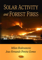
Milan Radovanovic, Jao Fernadno Pereira Gomes
Solar Activity and Forest Fires
Nova Science Publishers, New York, 2009.
Book description. This monograph especially emphasizes the importance of the scope, by which forest fires, from year to year endanger the environment, including casualties. Fire seized areas in 2000 in Europe only were over 920,000 ha. Cases relating to relatively small locations, but which burned in unsettled areas, are often unidentified, because the satellite sensors have limited possibilities in the view of the size of the area they can detect. It is similar to those situations on the fires with relatively short temporal range, and during that interval thick clouds are above such area for example and other admixtures stirring the atmosphere. It is necessary to point out that all those fire seized places, spatially limited on smaller localities, often cause fire spreading by their wideness and a sort of a plant mass, relief and geologic surface, humidity and precipitation or by suitable combinations. On the other side, especially in the last few years, we are witnesses to events when fire has seized tens of thousands hectares just in a “wave”, also penetrating through the urban areas.


