Maps and atlases

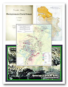
All the special editions of maps and atlases published by the Institute are available from the Institute library as printed editions, while insert maps, additional maps and cartographic sketches are to be found not only in Institute publications but also in many other publications of scientific and publishing institutions, in this country as well as abroad.
The main maps and atlases

Mirčeta Vemić, Ph.D. (2012):
A Map of the Peasants Uprising in the Vidin Pashalik in the Year 1850.
Mirčeta Vemić, Ph.D. (2005):
An Ethnic Map of a Part of Old Serbia. Based on the Travelogue of Miloš S. Milojević 1871–1877
Predrag Djurović, Ph.D. (1998):
Milan Bursać, Ph.D. (1992):
The Distribution of Serbs, Montenegrins and Yugoslavs in the Republic of Bosnia and Herzegovina and the Republic of Croatia, 1:1,000,000
The Geodynamics Board of the Serbian Academy of Sciences and Arts (1992):
A Geomorphological Map of Yugoslavia, 1:500,000
Miloš Zeremski, Ph.D. (1990):
A Geomorphological (Morphostructural) Map of Serbia, 1:500,000
Miroslav Milojević, Ph.D., Marina Todorović (1984):
The Socialist Autonomous Province of Kosovo – the Agrarian Population Density per Municipality
Miroslav milojević, Ph.D. (1984):
The Area of the City of Belgrade – an Agricultural Map
Miroslav Milojević, Ph.D., Marina Todorović (1983):
The Socialist Autonomous Province of Vojvodina – the Agrarian Population Density per Land Registry Municipality
Miroslav Milojević, Ph.D., Marina Todorović (1983):
The Municipality of Gornji Milanovac – an Economic Map
Miroslav Milojević, Ph.D., Marina Todorović, Radmilo Jovanović (1983):
Šumadija – the Density of Population per Land Registry Municipality
Miroslav Milojević, Ph.D. (1983):
The Socialist Republic of Serbia – Agricultural Land Based on the Manner of Exploitation per Municipality
Miroslav Milojević, Ph.D. (1983):
The Municipality of Ljubovija – an Economic Map
Miroslav Milojević, Ph.D. (1982):
The Municipality of Mladenovac – an Agricultural Map
Miroslav Milojević, Ph.D. (1979):
The Municipality of Valjevo – an Economic Map
Miroslav Milojević, Ph.D. (1969):
The Socialist Autonomous Province of Vojvodina – an Agrarian-geographic Map
Miroslav Popović, Ph.D., Miroslav Milojević, Ph.D. (1962):
The People’s Republic of Serbia – an Agrarian-geographic Map – the Distribution of Plant Production


