Available
for reading

Available to read since 2013
Mirčeta Vemić
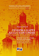
Ethnic map of a part of Ancient Serbia
The Geographical Institute “Jovan Cvijić” of the Serbian Academy of Sciences and Arts, special editions, vol. 61, Belgrade, 2005.
Book description. The work of Dr Mirčeta Vemić, as it can be seen from the title, represents a cartographic deed wherein are transponed three notebooks of travel-record by Miloš S. Milojević, in an expert manner, as visual geographic-cartographic notion about one part of the history of Ancient Serbia, especially settlements in Kosovo and Metohija, with addition of Kuršumlija nahiya. By methodological procedure of systematization of Milojević’s numeric data about the number and distribution of settlements and population, the author brought up, showed, ethnic picture, composition according to ethno-folk and religion-confessional criteria, bringing up Milojević’s travel-records data simultaneously as demographic-statistic structure of inter-relation of Serbs and Albanians at the end of 1860-ies and the beginning of 1870-ies of the 19th century; immediately shortly before Serbian-Turkish wars in 1876, 1877/78, that will basically change the former ethnic situation and demographic state and almost radically change in, previous relations, really conversely, reciprocal direction: Serbs will from the majority become the minority, and Albanians will from the minority become the majority population on territories of the present Kosovo and Metohija.


